Storm Benjamin warnings reduced across UK after bringing heavy rain and wind
Storm Benjamin, named by Météo France, brought heavy rain and strong winds to the UK on Thursday, though warnings were later reduced as the system cleared.
October 23, 2025 - 11:50 AM ET • 3 min read
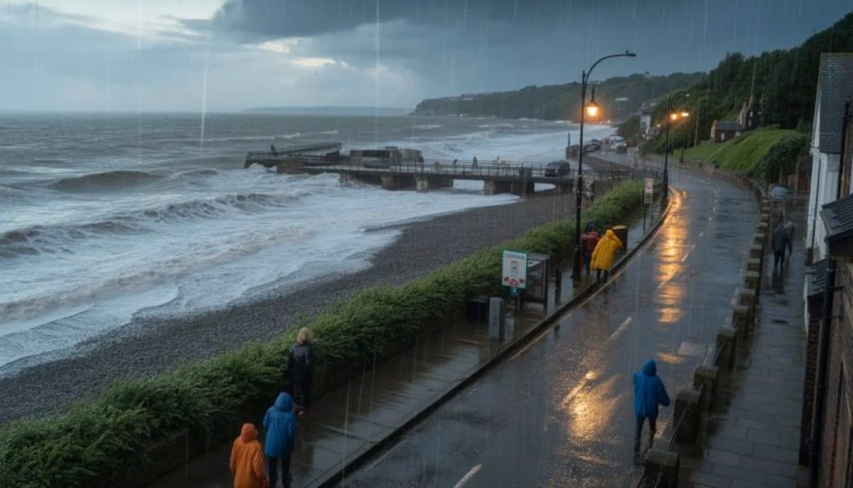
Storm Benjamin, a system named by the French weather service Météo France, brought wet and windy conditions across the United Kingdom on Thursday, prompting the Met Office to issue multiple yellow severe weather warnings for rain and wind across England and Wales.
As the storm moved through the English Channel and cleared away to the east toward the North Sea, forecasters noted that the impact on the UK began to lessen. Initial warnings covering large areas of southern and eastern England and Wales were subsequently reduced.
The storm's arrival led to widespread disruption concerns, primarily due to heavy rainfall and strong winds. The initial yellow warning for rain covered much of southern and eastern England and east Wales, coming into effect from midnight Wednesday night and extending through Thursday.
Forecasters anticipated significant rainfall totals. Across the affected areas, 20–30mm of rain was widely expected by early Thursday morning, with some places potentially seeing 30–50mm. There was a small chance that isolated areas, particularly in the East Midlands, Lincolnshire, Humberside, and East Anglia, could exceed these totals, potentially reaching up to 90mm.
In Wales, separate warnings were issued for rain and wind. The rain warning covered southern counties, including Cardiff, Swansea, and Newport, where up to 30mm of rain was expected over a few hours, with localized totals reaching 50mm. Officials warned that these conditions could lead to hazardous road conditions and the possibility of localized flooding.
A separate yellow warning for strong winds covered western Welsh counties, including Pembrokeshire and Anglesey. Wind speeds were expected to reach 45 mph inland, with gusts potentially hitting 55 mph along the coast.
While four yellow weather warnings were initially in place across large swathes of England and Wales, the Met Office reduced these as the storm tracked eastward. By Thursday afternoon, only two warnings remained active.
The remaining warnings included a yellow warning for rain covering Norfolk and Suffolk, valid until 16:00 BST, and a yellow warning for wind across eastern England, valid until 15:00 BST. Forecasters noted that while the strongest winds remained offshore in the North Sea, the continued rainfall across Norfolk and Suffolk still carried a low chance of localized flooding.
Although Storm Benjamin brought disruption to the UK, the most severe impacts were felt across continental Europe. The storm delivered its most violent winds to the northern coast of France, where gusts reached up to 100 mph. Belgium and the Netherlands were also expected to experience significant effects from the system. Météo France, the agency responsible for naming the storm, confirmed that the system was moving rapidly across the region.